User guide#
This section provides an overview of the PyAnsys Geometry library, explaining key concepts and approaches for connection, primitives, sketches (2D basic shape elements), and model designs.
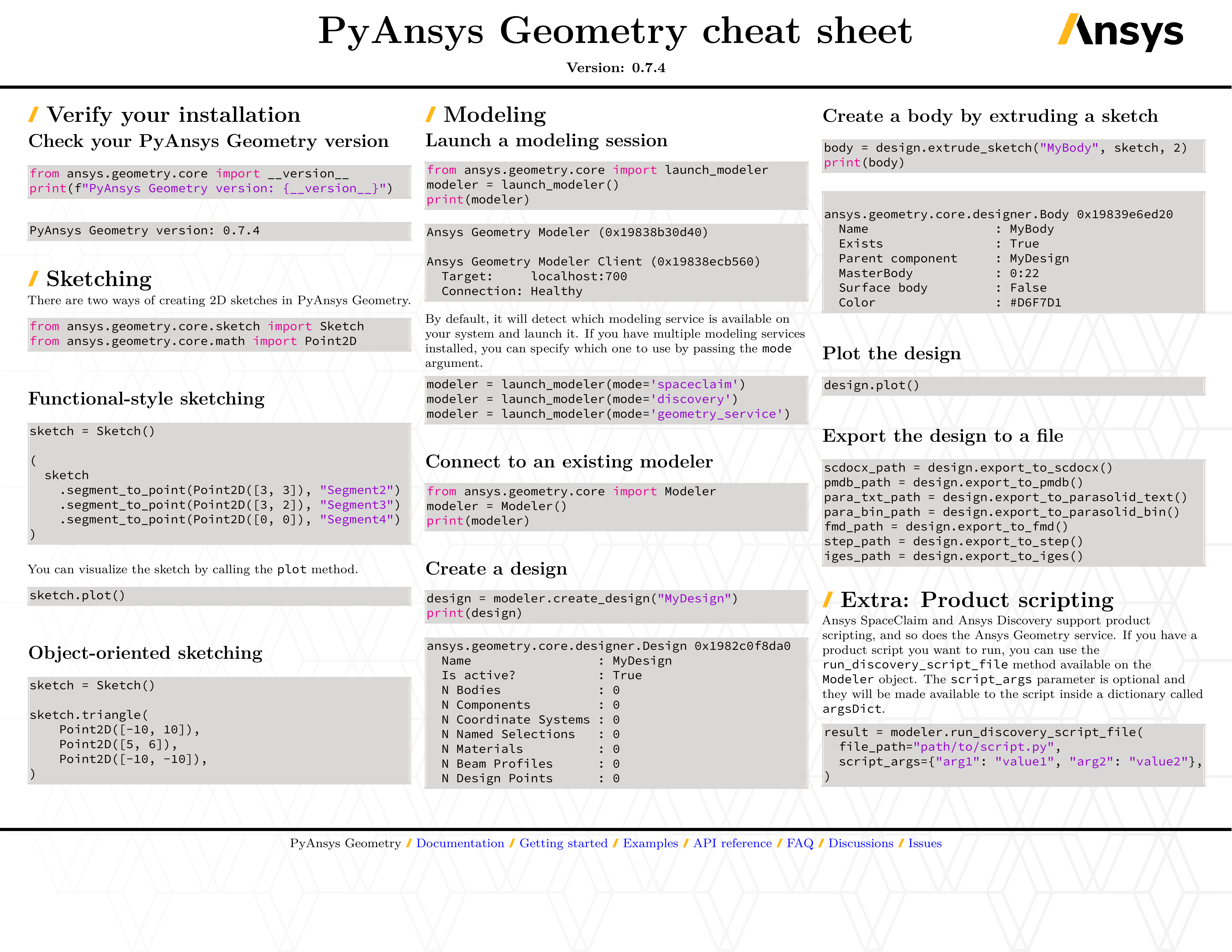
PyAnsys Geometry overview#
PyAnsys Geometry is a Python wrapper for the Ansys Geometry service. Here are some of the key features of PyAnsys Geometry:
Ability to use the library alongside other Python libraries
A functional-style API for a clean and easy coding experience
Built-in examples
Simple interactive example#
This simple interactive example shows how to start an instance of the Geometry server and create a geometry model.
Start Geometry server instance#
The Modeler() class
within the ansys-geometry-core library creates an instance of
the Geometry service. By default, the Modeler instance connects to
127.0.0.1 ("localhost") on port 50051. You can change this
by modifying the host and port parameters of the Modeler object,
but note that you must also modify your docker run command by changing
the <HOST-PORT>:50051 argument.
This code starts an instance of the Geometry service:
>>> from ansys.geometry.core import Modeler
>>> modeler = Modeler()
Create geometry model#
Once an instance has started, you can create a geometry model by initializing the sketch subpackage and using the shapes subpackage.
from ansys.geometry.core.math import Plane, Point3D, Point2D
from ansys.geometry.core.misc import UNITS
from ansys.geometry.core.sketch import Sketch

# Define our sketch
origin = Point3D([0, 0, 10])
plane = Plane(origin, direction_x=[1, 0, 0], direction_y=[0, 1, 0])

# Create the sketch
sketch = Sketch(plane)
sketch.circle(Point2D([1, 1]), 30 * UNITS.m)
sketch.plot()